Did you know that Colorado is actually spelled h-i-k-i-n-g?
When discussing the great outdoors, the scene that pops in to your head is probably found in Colorado. Whether it’s a mountain trail with an incredible view or someone careening down a snowy mountain peak on skis, Colorado is king of the outdoors in the lower 48.
Here, we’ll focus on one facet of outdoor activity — hiking.
During the months I’ve spent in the Denver area, my wife and I hiked A LOT.
It can be incredibly overwhelming deciding which hikes to do when there are thousands of world-class trails to choose from. Particularly when you only have a few days of vacation to do so.
So, to help you out, here are 11 incredible hikes that I’ve enjoyed during my time based in Denver and Georgetown:
Nymph, Dream, & Emerald Lake
Length: 3.2 mi | Elevation Gain: 700 ft.| Difficulty: Moderate
If we’re talking about hikes near Denver, what would this list be without including Rocky Mountain National Park. One of the most popular parks in the country and for good reason. It’s about one and half hours driving from Denver, costs $30 for entry, and while it can be crowded, it’s worth the effort.
This park is what you dream of of when you picture a mountain getaway. Spectacular peaks, crisp air, alpine lakes, and wildlife, this park has it all.
There are countless hikes to choose from, but I’ll just include one Rocky Mountain hike on this list: the hike around Nymph, Dream, & Emerald Lakes.
Why this one in particular? Well, you’re entertained throughout the hike as each lake seems to out-do the previous. At Dream Lake, you’ll have an awesome view of Flattop Mountain and once you get to Emerald Lake your mind will be blown by the scenery.
It’s one of the most popular spots in the park and you’re sure to see images of it when googling Rocky Mountain National Park. With that in mind, avoid crowds by going earlier than everyone else! That also gives you a much better chance to see some cool wildlife. Always pack enough water, throw on the sunscreen, and keep our parks clean!
Map info here!
Image by Daniel Hayes (IG: indecisive_travels)
Mt. Bierstadt Trail
Length: 7.8 mi | Elevation Gain: 2,765 ft. | Difficulty: Hard
Mt. Bierstadt stands tall, peaking at a whopping 14,065 feet, making it one of 58 “14ers” in Colorado. For those who don’t know what that means, a “14er” is cool talk for a mountain peak above 14,000 feet. This was our first time hiking at such elevation and luckily for us we had some native Coloradians (?) give us some good pointers. It will pay off to prepare yourself for high altitude if you’re not accustomed to it. A bout with elevation sickness will definitely ruin your hike.
One of the most important ways to prepare is to drink LOTS of water! Hydration is key. If you have the time, it also pays off to start with lower altitude climbs and work your way up to climbing the big boys. I’m sure these points will be reiterated throughout this article so be prepared.
Anywho! About the actual hike. This hike crushed our souls, I’m not going to lie. If you’re looking for a sweet little jaunt through the forest, pass this one. However, if I could let it crush my soul again, I would. The reward you get from conquering this hike is well worth it. Alongside the feeling of accomplishment, you get incredible views of gorgeous sweeping meadows.
Map info here!
Image by Daniel Hayes (IG: indecisive_travels)
Echo Lake to Idaho Springs Reservoir
Length: 4.0 mi | Elevation Gain: 761 ft. | Difficulty: Moderate
Starting from the beautiful Echo Lake in Mt. Evens Wilderness area, this is an awesome hike that brings you to a gorgeous and remote reservoir called Idaho Springs Reservoir. This is an easily accessible hike and it’s a lovely drive up the mountain to get there. Basically you’re already rewarded before you even start the hike… ah, thanks Colorado!
I’d say this is a relatively easy hike. 761 ft, over 4 miles sounds easy, but don’t be fooled, that 761 ft. gain is pretty much all in one shot.
However, that means a lot of the hike is pretty easy going, walking along a gorgeous ridge overlooking endless forest for most of the way before descending down and finding the reservoir.
Once you’re there, congrats! You’re now in a screensaver.
Crystal clear waters shadowed by glorious mountains on all sides makes it the perfect place to rest up before your venture back up the trail.
I forgot to mention earlier, but this hike is off Mt. Evans road, which requires a fee for entry, but I promise it’s still worth it!
Map info here!
Image by Daniel Hayes (IG: indecisive_travels)
McCullough Gulch
Length: 6.4 mi | Elevation Gain: 1,607 ft. | Difficulty: Hard
Here’s a toughy just outside Breckenridge for ya. This is a popular hike, so my advice for this trail would be to start early and, if you can, go sometime during the week. Also, prepare to hang a while since this hike typically takes 3-4 hours to complete.
On this hike you’ll climb up and through the forest meandering along a flowing creek for much of your journey. As you climb up you’ll run into a lovely set of waterfalls and pretty view to your back. You might think you’ve reached the pinnacle, but keep pushing to make it up to an even better view and pristine alpine lake to rest your feet at.
My wife and I made the mistake of starting late and even almost got lost in the dark here, terrifying. So make sure you give yourself enough time!
Map info here!
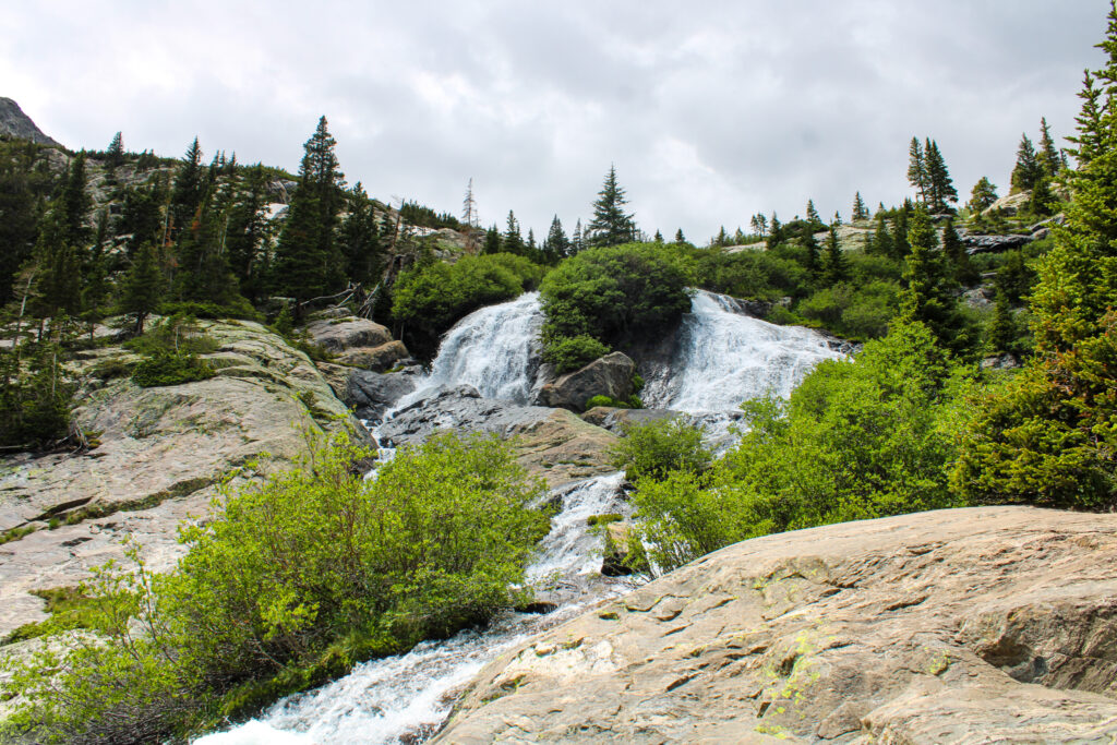
Image by Daniel Hayes (IG: indecisive_travels)
Griffin Memorial
Length: 3.7 mi | Elevation Gain: 1,177 ft.| Difficulty: Hard
While not the longest trail in Colorado, this trail gets its difficulty from the constant elevation gain. I mean, it feels like you’re pretty much walking up the entire time. Difficulty aside, I loved this hike because it doubled as a walk through history in some ways.
The hike starts in the tiny town of Silver Plume. Like many small towns in the area, Silver Plume was a former coal-mining town and has not much more than a saloon (Bread Bar, must go) and a cool little jail house to peek inside.
The hike takes you up through abandoned coal-mines that are equal parts interesting and spooky. Once you reach the top you’ll find the Griffin Memorial, named after Clifford Griffin, who was beloved by the miners he employed in Silver Plume.
As the legend goes, Griffin was sitting playing his fiddle where the memorial resides when a gun shot was heard. Miners found Griffin lying besides a grave he dug for himself, or did he?
Alongside the history and mystery, the view from the memorial is spectacular, making it an awesome hike near Denver and Georgetown.
Map info here!
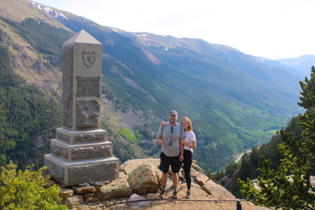
Image by Daniel Hayes (IG: indecisive_travels)
Silver Dollar Lake and Murray Lake
Length: 4.1 mi | Elevation Gain: 1,066 ft. | Difficulty: Moderate
Another hike near Denver worth checking out is the one that leads you to Silver Dollar Lake and Murray Lake. I liked this hike for it’s steady elevation gain, with no sections that are particularly daunting.
The trail rests above 12,000 feet so as a reminder, a great way to prevent altitude sickness is with plenty of water, carbs, and allowing your body time to acclimate to its surroundings!
This trail is very exposed as well so make sure to bring plenty of water, wear a hat, and throw on sunscreen! Even in the winter.
At such an elevation, you’re bound to be treated with some views, and this trail is no exception. Along this hike you will be greeted by three lovely alpine lakes.
What I loved about this hike is that each lake is sort of like a raised platform from the previous lake making your view from each lake better and better. By the last one you can even get a shot of two lakes in one!
Map info here!
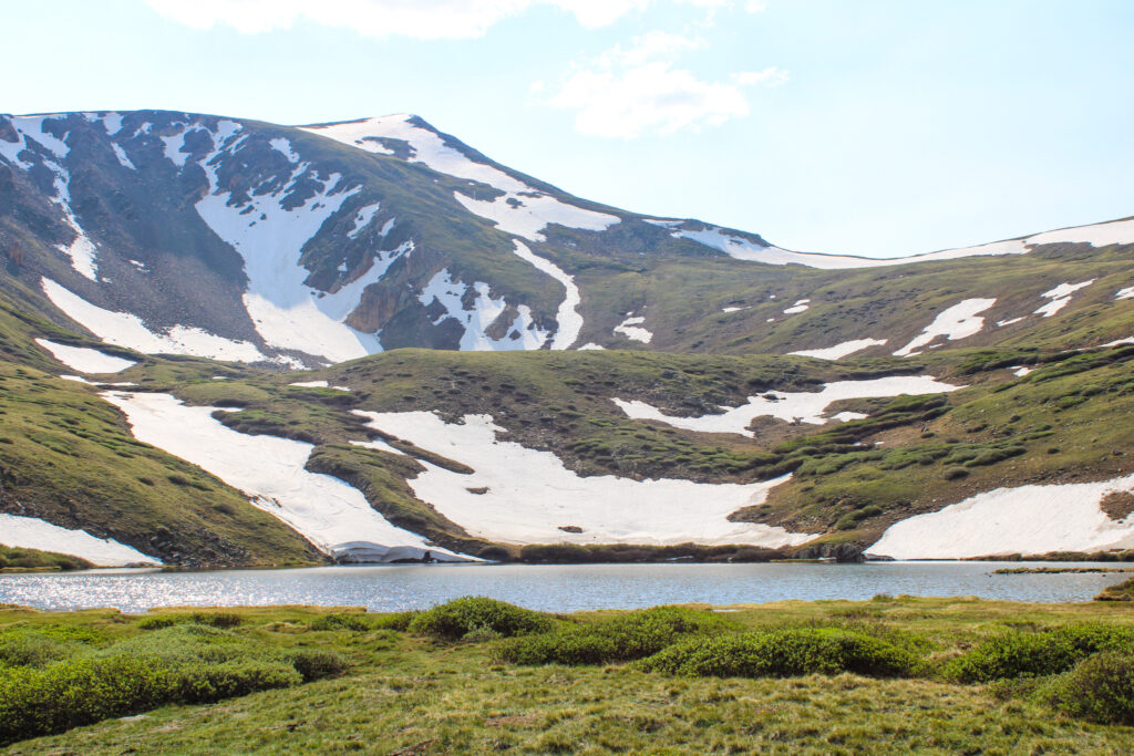
Image by Daniel Hayes (IG: indecisive_travels)
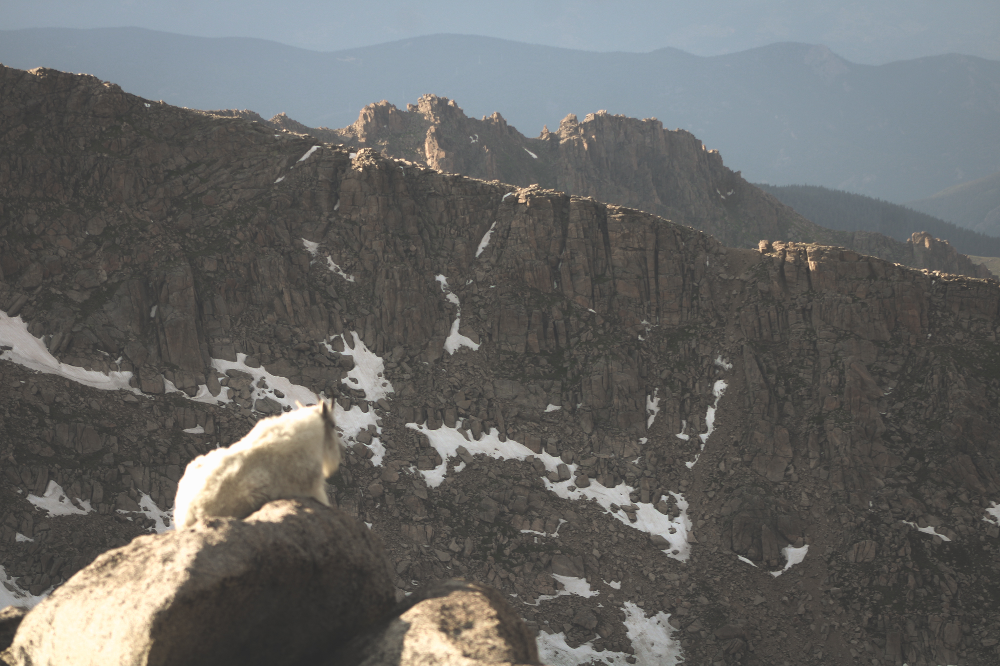
South Park 600 to Square Top Lakes
Length: 4.9 mi | Elevation Gain: 935 ft. | Difficulty: Moderate
Not too far from the previous hike is South Park 600 to Top Lakes. Located right off the stunningly scenic Guenella Pass, this trail gets you to two incredible alpine lakes.
The lakes are situated just below Square Top Mountain, which peaks at 13,794 ft.
They also offer some incredible views of the even larger 14ers in the area such as Bierstadt and Garys-Torrey, making it one of the most scenic hikes near Denver.
If you’re lucky you’ll get a chance to see some mountain goats, which are pretty common in that area and along Guenella Pass. You’ll also be presented with beautiful wild flowers on your way up to the lakes.
You won’t be able to see the top lake pretty much until you’re right up in it because it’s in a depression but once you’re there, kick back and watch the clouds, gaze up at Mt. Bierstadt’s might peak, and have yourself a snack. You deserve it.
Map info here!
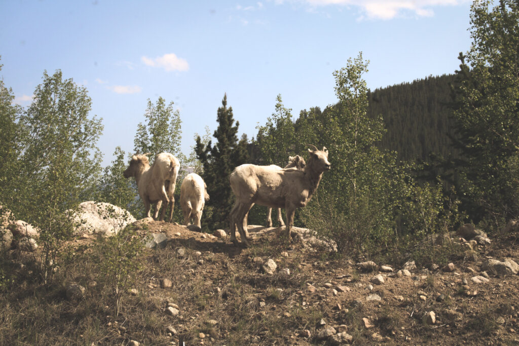
Image by Daniel Hayes (IG: indecisive_travels)
Castle Trail to Meadow Trail Loop
Length: 2.2 mi | Elevation Gain: 259 ft. | Difficulty: Easy
Okay, let’s chill out for a second and find something easy.
We adopted a 3 month old puppy right before arriving in Colorado and enjoyed taking him here to get him started as our new trail buddy.
We chose it because it’s relatively flat and not too long because we knew we’d be carrying this guy for most of the way.
However, this did not mean there was any sacrifice of beauty.
Not too far from Red Rocks Amphitheatre just outside of Denver, this hike has you going through a dreamy meadow and offers you some awesome views of the valley.
This is a great place to hike and picnic as there are many benches and picnic areas to hang out at and breathe in some fresh air. With such accessibility and ease, this is a popular spot for families looking for hikes near Denver, so plan accordingly!
Map info here!
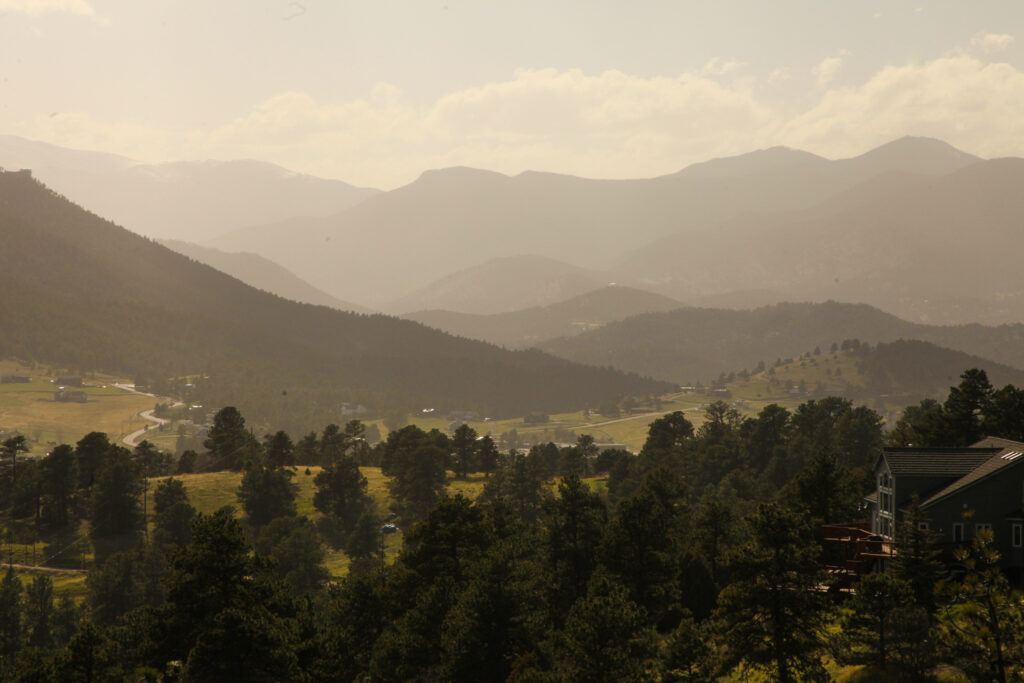
Image by Daniel Hayes (IG: indecisive_travels)
Red Rocks Trading Post Trail
Length: 1.5 mi | Elevation Gain: 357 ft. | Difficulty: Easy
Speaking of Red Rocks Amphitheatre, you should visit it! Afterwards go for a jaunt through Red Rock Mountain Park via Red Rocks trail. Being so close to the city, it’s one of the easiest hikes to get to near Denver. Foothills dotted with beautiful protruding red rocks provide you with some incredible scenery.
This is a great hike for a family, as it’s relatively flat and easy going, but there are a couple things to know before going for this trail.
Firstly – make sure you bring a TON of water and apply sunscreen like you’re frosting a cake, as the trail is pretty much completely exposed.
It also should be noted that Red Rocks Amphitheatre is super popular even when there isn’t a show, so the area will be crowded! Get there early if you want good parking and a hike with a little less people on the trail. Event Days often close the park area by 2pm, so make sure you do a little research before heading out.
Map info here!
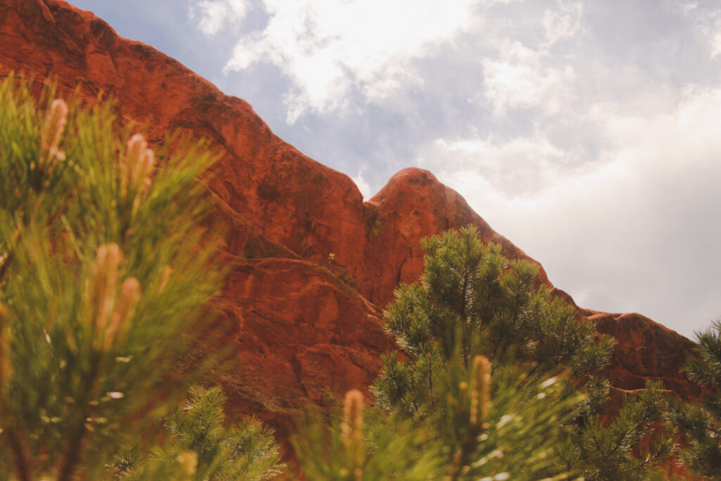
Image by Daniel Hayes (IG: indecisive_travels)
Flatirons Vista Trail
Length: 3.5 mi | Elevation Gain: 285 ft. | Difficulty: Easy
When you’re this close to Boulder, I say you have to make the trip.
Just a 30-40 minute ride from Denver or a little over an hour if you’re in one of the surrounding mountain towns, it’s a must see for those looking into hikes near Denver. The town, of course, but particularly one hiking area called the Flatirons.
There are plenty of trails to choose from, but the Flatirons Vista Trail is delightfully pleasant and gives you an awesome view of the diagonally jutting boulders spectacularly erupting from the earth. It’s as if a wind came that was so strong it nearly blew the mountain down.
Beneath the Flatirons is a gorgeous meadow that’ll tempt you for the entirety of the hike and run across spinning and laughing barefoot. Also, it’s dog friendly!
I believe a visit to Boulder is a must for anyone visiting nearby, especially those looking for hikes near Denver. The hike starts just at the end of town and there are some delicious options for refreshments after your hike right in town.
Map info here!
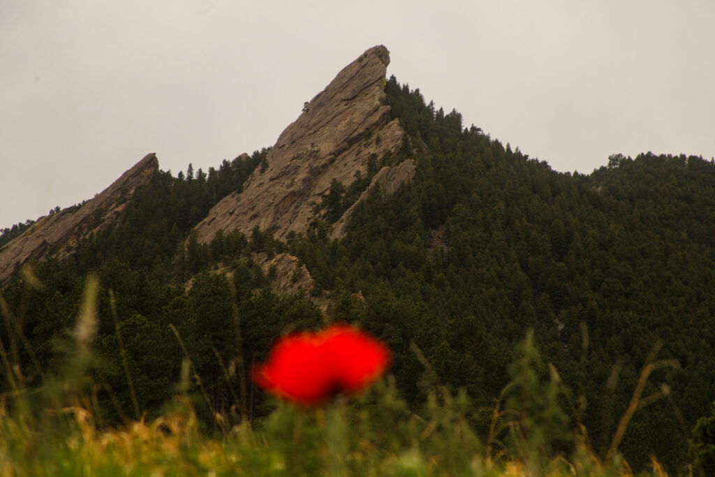
Image by Daniel Hayes (IG: indecisive_travels)
Palmer, Buckskin-Charley, Niobrara, and Bretag Trail Loop
Length: 4.0 mi | Elevation Gain: 449 ft. | Difficulty: Easy
Garden of the Gods might be more a trip than any of the other areas on this list, taking about 2 hours driving from Denver in Colorado Springs. However, it’s one of the most beautiful places to see in Colorado and therefore I felt like I had to include a hike in the area on this list.
As you approach the park you’ll start to see gorgeous red rock structures reaching for the skies. It looks like someone went to Moab or somewhere in southern Utah/Arizona and dragged back magnificent red clicks to display in Colorado.
Of course, this a popular site in Colorado and to best avoid crowds, try to arrive early and on a weekday if possible.
This trail is well maintained and gives you lovely views of rock structures. If you’re adventurous enough, this is also a popular area to rock climb!
Along our hike we found ourselves gazing up at a few people climbing up the cliff sides. Get up early, take the drive and plan a picnic, it’s an excellent day trip and you won’t regret it!
Map info here!
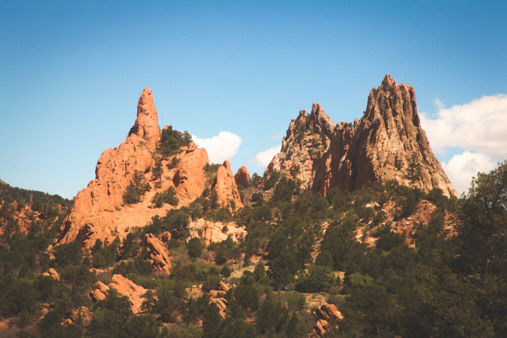
Image by Daniel Hayes (IG: indecisive_travels)
Did we miss any of your favorite hikes in or around Denver?
Let us know in the comments so we can add more recommendations to our list!